Great Walk | The Heaphy Track, New Zealand

Abstract watercolor painting of palms, rainforest and grassland inspired by the Heaphy Track in Kahurangi National park in New Zealand.

Great Walk, watercolor on paper, 25”x50” (now with a proud new owner, my friend Richard Ervais!).

In fall 2017 I spent about three weeks traveling around the North and South Islands of New Zealand. Four worldviews have come out of that experience—there will be more!—including the recently completed Great Walk, inspired by the Heaphy Track in the northwest corner of the South Island.

The Heaphy Track is one of seven “Great Walks” throughout the country—multi-day treks of exceptional environmental interest maintained to a certain standard including electrified huts. The most famous of these is the Milford Track, which I did also, and you’ll definitely hear about that one too later on. But while the scenery was less dramatic, the Heaphy Track made a greater impression on me in terms of its diversity of species and ecosystems.

New Zealand with the Heaphy Track location in red.

New Zealand with the Heaphy Track location in red.

The Heaphy Track (from the New Zealand Department of Conservation).

The Heaphy Track (from the New Zealand Department of Conservation).

The 4-day “walk” (I love how the Kiwis call them “walks,” as if they’re everyday activities, and in fact they’re much more ingrained in the culture than something comparable in the USA) runs about 50 miles through Kahurangi National Park, taking in subtropical coastline, varied forest types, and high-altitude grasslands. It can be done in either direction; most walk east-west, beginning at the foot of the mountains and ending at the coast, though for logistical reasons I did it in reverse. As I’ll talk more about below, I was reminded that if such environmental journeys are experienced as narratives (which for me they always are), directionality matters as much as it would for a novel or symphony with its structure read or heard backwards.

Beach on a cloudy day with rainforest and nikau palms along the Heaphy Coast, New Zealand

Nikau palms along the coast, a few hours into the trek.

Rainforest with nikau palms behind the beach along the Heaphy Track, New Zealand

Rainforest with nikau palms behind the beach.

Day 1 began in the early afternoon in a light rain (actually much better weather than predicted), on a trail hugging the coastline just a few meters back from a string of beaches. Occasionally the sand is interrupted by rocky outcroppings lifting the trail upward for dramatic views along the coast, or by streams crossed by narrow suspension bridges. (Until a few years ago these stream crossings were done on foot, requiring close attention to weather and tides and resulting in more than a few tragedies.)

The most striking thing about this part of the South Island coast should be obvious from the photographs. Though at a latitude roughly equivalent to that of New York, thanks to a warm ocean current this coastline is home to the world’s southernmost naturally-occuring palm, the nikau (Rhopalostylis sapida), which is the dominant canopy species in the rainforest fringing these beaches. The nikau is noteworthy not just because palms in general are unexpected this far south, but because such a tropical-looking palm is even more surprising. Most of the world’s other hardiest palms—the Mediterranean fan palm, the needle palm, the dwarf palmetto—look decidedly non-tropical, with their shrubby forms and fan-shaped leaves. This is considered subtropical rainforest (or even temperate by some measures), but aside from the pleasant temperatures it feels as tropical as any in the quintessential “South Pacific.”

At the start of Day 2, the trail turned inland and began to climb. The palms became sparser and eventually disappeared, the exotic look of the rainforest sustained by tree ferns and giant heaths (genus Dracophyllum—in the same family as azaleas but looking deceptively like tropical houseplants). It was at this point that I started wishing I had done the walk in the more popular direction. Most people choose to end at the coast, because of the dramatic ocean views that open up on the last day plus the fact that the beach always feels like an appropriate place to end a long hike. For me though, given my obsession with palms, the reason had more to do with wishing I could have experienced the transition from temperate to tropical-like, seeing the palms slowly appear and then overwhelm. It seemed like a more natural progression, maybe because traveling from the more-familiar to the less-familiar is a storyline that tends to leave us with the strongest impressions. Briefly I decided that one day I would come back and do the walk again “properly”—though that conviction faded as I gradually realized the current progression was in fact creating its own unique narrative. More on that later.

Rainforest with nikau palms along the Heaphy Track, New Zealand

Rainforest at a slightly higher elevation as the trail turns inland.

Rata tree and tree fern in lush rainforest along the Heaphy Track, New Zealand

A gigantic southern rata, Metrosideros umbellata, with my hiking poles (bottom center with white handles) for scale.

Giant rata tree with epiphytes in rainforest along the Heaphy Track, New Zealand

Looking up toward the canopy of the tree in the previous image.

Heath (Dracophyllum) in rainforest along the Heaphy Track, New Zealand

Giant heath (Dracophyllum sp.).

As the trail climbed higher and slowly began to level out, the character of forest became coarser, shorter, and “drier” (probably because of a change in soil type rather than precipitation), with decreasing species diversity. The tree ferns disappeared, though the occasional tropical-looking heath still stood out sharply against the tiny leaves of the surrounding foliage.

Rainforest along the Heaphy Track, New Zealand
Rainforest with tree ferns along the Heaphy Track, New Zealand
Forest along the Heaphy Track in New Zealand.

This and previous 3 images—the changing look of the forest as the trail climbs.

Boggy tussock grassland in the Gouland Downs along the Heaphy Track, New Zealand

A boggy area of the Gouland Downs (the white on the trees in the background is a trick of the morning light, not snow).

Early on Day 3, the scrub gave way to a boggy, moody tussock grassland (the sky was mostly overcast with off-and-on rain) known as the Gouland Downs. While the landscape does look alpine in some ways, the absence of trees is due to the poor, wet soil rather than low temperatures—the elevation is only around 800m/2,600’—and in fact the grasslands are surrounded and broken up by forested hills, mountains, and rocky karst zones. Given the overall temperate look of the vegetation, I actually found the place vaguely reminiscent of a field-and-forest matrix in Europe or the Eastern USA, as English settlers apparently did too when they tried and failed to graze sheep there in the 1800’s. In any case the tropical-looking nikau forest felt a whole lot farther away than a day’s walk, a sense of separation amplified by the self-contained feel of the Downs—a special world unto itself. The forested mountains blocked any views or reminders of the more luxuriant environments below.

Tussock grassland in the Gouland Downs along the Heaphy Track, New Zealand

Looking across the Gouland Downs.

Toward the end of the day, the trail left the Downs and passed into the forest again—one very different from any of the previous types. Those were either scrubby or rainforest-y depending on the substrate; the higher-elevation ones certainly felt temperate, but still like Southern Hemisphere forests because of the unfamiliar species. This one felt like a typical forest in the northeastern USA—I think it was some combination of the spindly trees and light, ash-like foliage. It certainly seemed like I had temporarily left New Zealand.

The Enchanted Forest, mossy beech forest in a karst area along the Heaphy Track, New Zealand

The Enchanted Forest—mossy, gnarled beech forest in a karst (limestone) area within the Downs.

Forest along the Heaphy Track in New Zealand.

“Non New Zealand-like” forest on the other side of the Downs.

Day 4 began just before sunrise in a driving wet snowstorm. Reaching the highest point of the trip, first light revealed tropical-looking heaths with a light covering of ice, framing a view of snowy mountains across the valley that I would be following for the remainder of the walk. The weather improved, soon becoming sunny, as I descended again into ferny temperate rainforest. About 4 hours later I began to catch glimpses of an agricultural valley through the trees, the topography leveled out, and the trail exited the forest.

Giant heath at the highest point of the Heaphy Track in New Zealand, with snowy mountains beyond.

Sunrise vista from the highest point of the walk, with giant heaths in the foreground.

Rainforest along the Heaphy Track, New Zealand

Heading downhill and back into the rainforest on the last segment of the hike.

Looking back toward the mountains across rainforest at the end of the Heaphy Track, New Zealand

The end of the trail, looking back toward the mountains.

In the next post I’ll describe how I distilled my experience of the Heaphy Track into Great Walk—stay tuned!

Darren

Sanctuary | National Park and Worldview

This post picks up where I left off two posts ago with Strzelecki National Park on Flinders Island, Tasmania, and the worldview it inspired. The Park protects the most intact and diverse ecosystems of the island, where I did a month-long artist residency at Mountain Seas Art and Wilderness Retreat in September 2017.

Darren_ResidencyPresentation4.jpg

Strzelecki National Park, and the relatively pristine mountains and coastline adjacent, has only three interior routes. The 4-5 hour round-trip hike to Strzelecki Peak begins about a 15-minute bike ride from Mountain Seas; a much longer but basically level one follows a road and 4wd track just inland along the south coast; and an hour-long walk winds along the coastline north from Trousers Point.

I hiked to the summit twice, both times lucking out with the weather. It’s definitely in my top five day-hikes of all time, and isn’t difficult except for a few steep, rocky patches near the top. The trail begins in dry mixed and Eucalyptus forest, punctuated by bare or scrubby areas of granite boulders and cut by a dramatically lush, tree-fern filled rainforest gully. As the trail rises and approaches the sheer cliffs of the peak, the rocky areas become more frequent.

Eucalyptus and tree ferns at a rainforest gully in Strzelecki National Park, Flinders Island, Tasmania, Australia

Rainforest gully surrounded by Eucalyptus forest.

Dicksonia and Cyathea tree ferns in a cool rainforest gully in Strzelecki National Park, Flinders Island, Tasmania, Australia
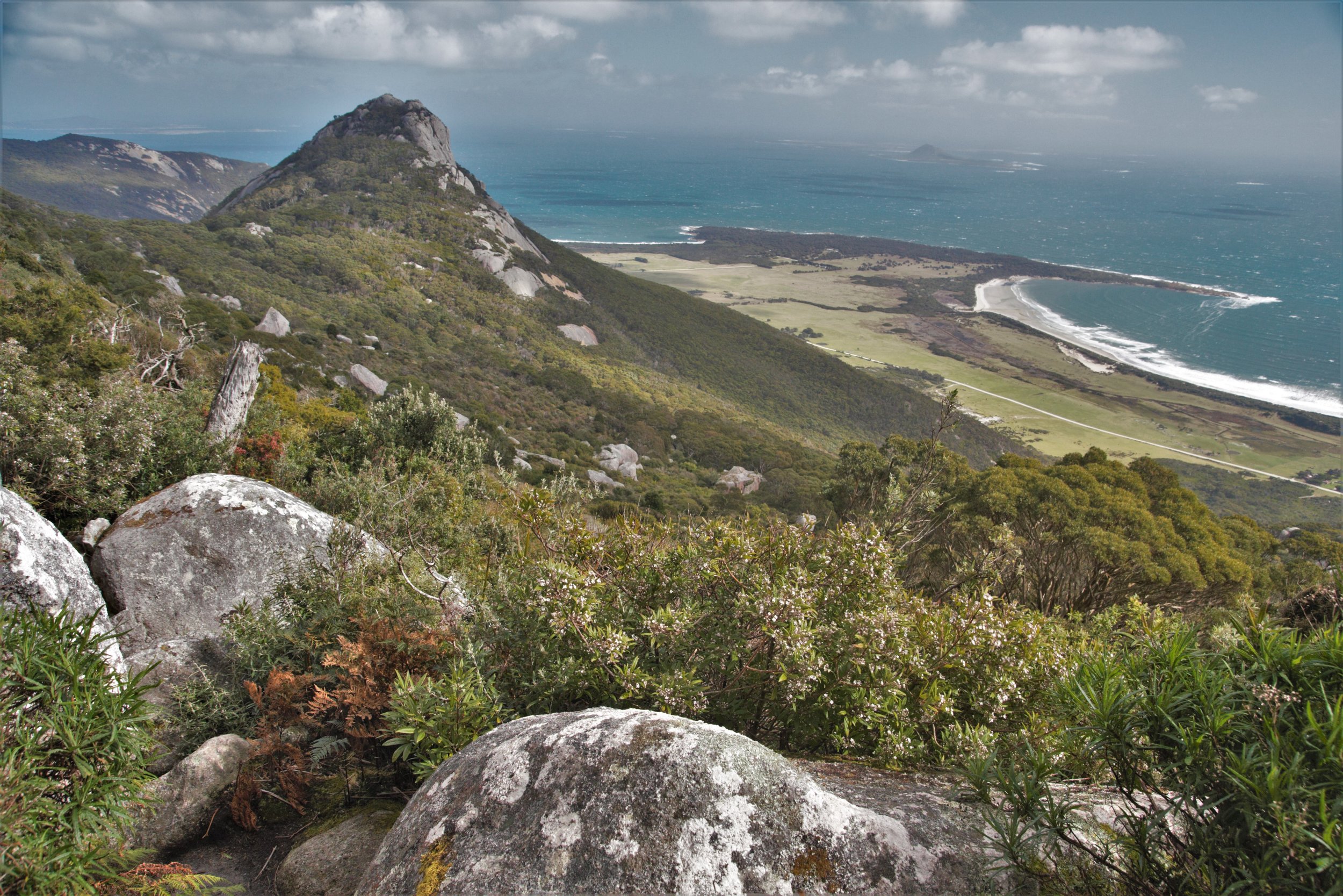
View of forested slopes and granite cliffs of Strzelecki Peak, Flinders Island, Tasmania, Australia

View of Strzelecki Peak (above my head) from the lower slopes.

Boulders and montane scrub vegetation with coastal views on the hike to Strzelecki Peak, Flinders Island, Tasmania, Australia

Mid-slope view down to Trousers Point.

Patches of montane rainforest start to appear, mossy and windswept. Where the soil allows, the rainforest becomes more luxuriant, though unlike the gully far below the tree ferns are short and ragged. It’s wet enough for them up there but almost too cold—an ecological “zone of tension” (there’s probably a proper scientific term for that?), world-shrinking in the way that I experience other ecotones but here in a particularly visceral way. Reaching the peak itself, the vegetation becomes drier and sparser once again, reaching tree-height only in pockets between the boulders.

Windblown trees in montane rainforest near Strzelecki Peak, Flinders Island, Tasmania, Australia

Wind-sculpted rainforest approaching the Peak.

View of Strzelecki Peak with scrubby vegetation and rocky cliffs, Flinders Island, Tasmania.

View of the Peak from below the last push.

View across Flinders Island, Tasmania, from near Strzelecki Peak, with montane rainforest vegetation.

Tree ferns near the upper limit of their range.

Tree fern in montane rainforest near Strzelecki Peak, Flinders Island, Tasmania, Australia
Montane rainforest and tree ferns near Strzelecki Peak, Flinders Island, Tasmania, Australia

Rainforested slope just below the Peak.

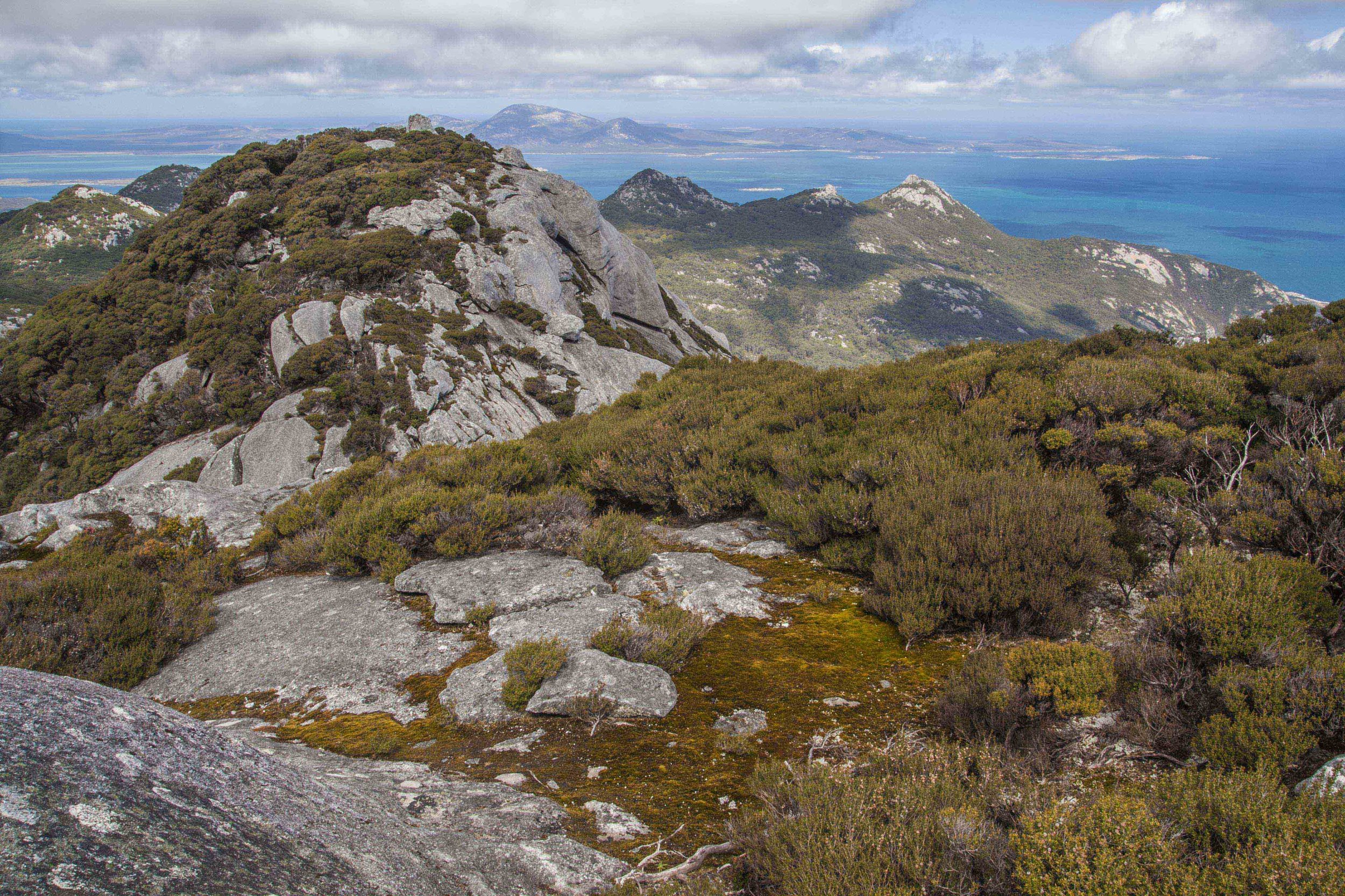
View south from Strzelecki Peak with scrub vegetation and granite outcroppings, Flinders Island, Tasmania, Australia

View south from the summit.

The south coast walk is more homogeneous given the constant elevation, though it passes through impressive stands of grass trees (Xanthorrhea australis) and provides access to a number of completely empty, idyllic beaches and areas of coastal forest.

Beach, turquoise water and red rocks (colored by algae) in Strzelecki National Park on Flinders Island, Tasmania, Australia

A few of the south coast’s many empty beaches.

Beach and coastal forest in Strzelecki National Park on Flinders Island, Tasmania, Australia
Grass trees (Xanthorrhea australis) near the coast in Strzelecki National Park on Flinders Island, Tasmania, Australia

Grass trees in dry forest along the south coast.

Grass trees with coastal forest and view of the ocean in Strzelecki National Park on Flinders Island, Tasmania, Australia

The short coastal walk from Trousers Point joins two more spectacular beaches, but the combination of windswept coastal heath, giant boulders (stained red by algae) and open views is unique on the island. I did that walk two or three times, the last on one of my final nights during a spectacular sunset that worked magic on the red ground and ochre vegetation.

Windblown coastal forest and heathland in Strzelecki National Park on Flinders Island, Tasmania, Australia

Coastal heath vegetation, backed by windblown forest, near Trousers Point.

Coastal heath vegetation near Trousers Point in Strzelecki National Park on Flinders Island, Tasmania, Australia
View of Strzelecki Peak across coastal heath vegetation on Flinders Island, Tasmania, Australia

Coastal heath near Trousers Point at sunset, with Strzelecki Peak hidden in the clouds beyond.

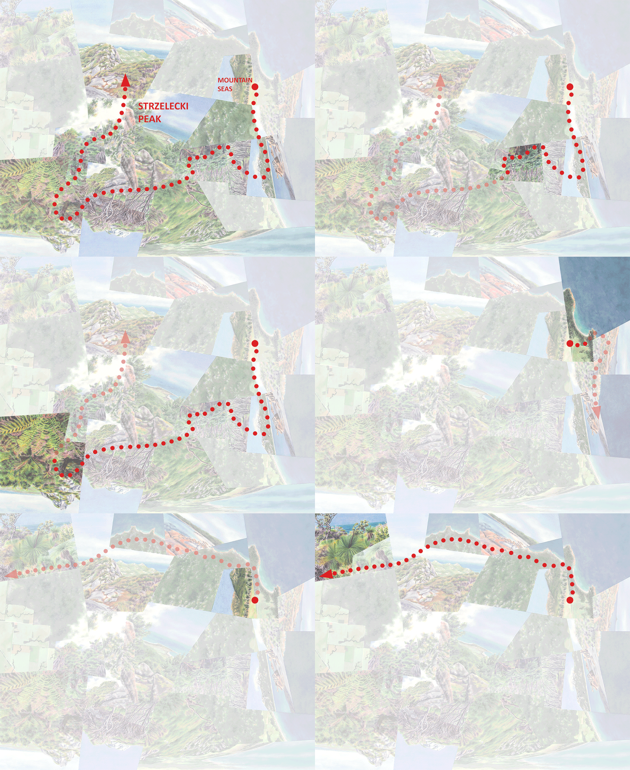
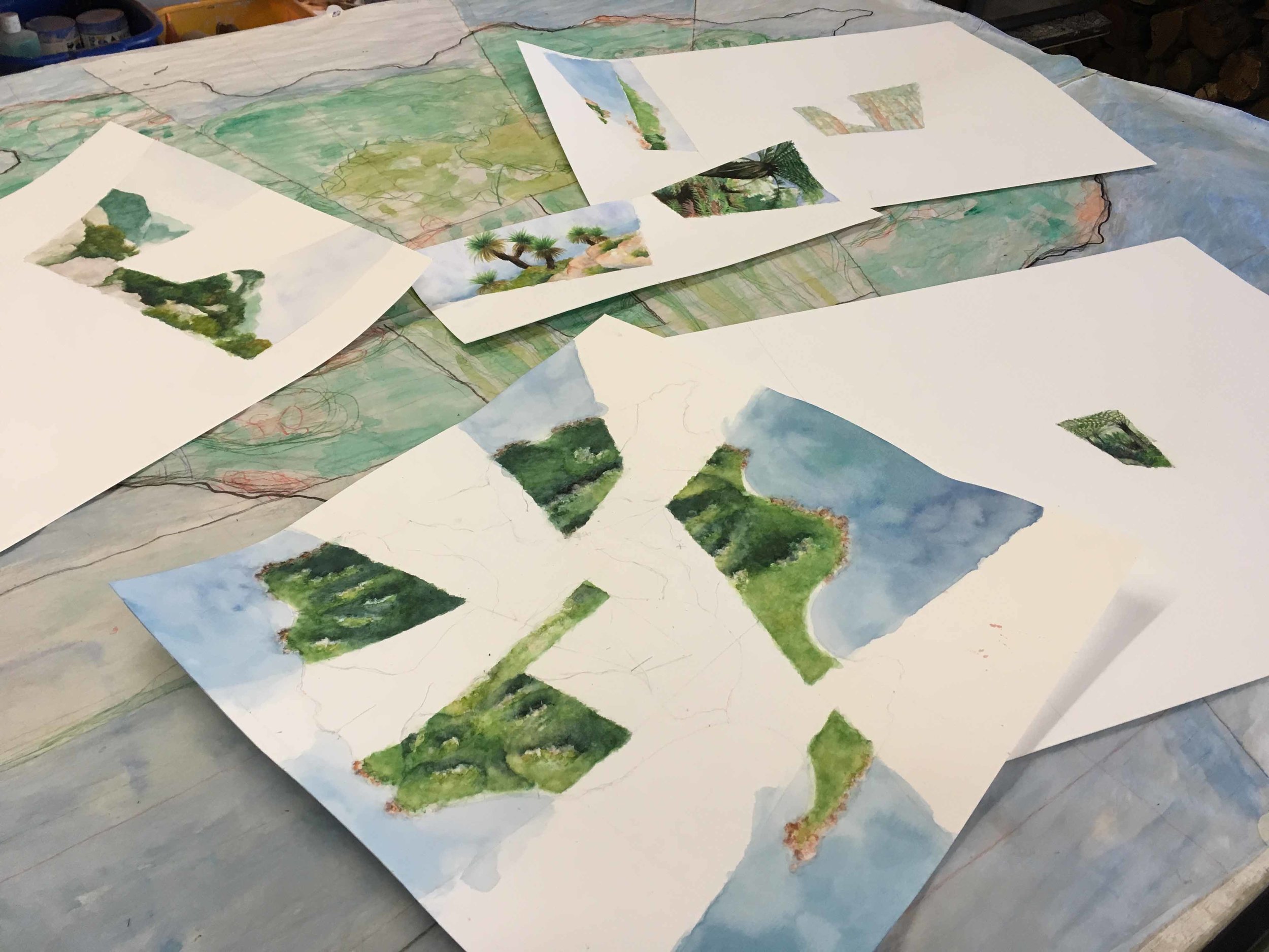
After walking each trail once, I decided that although the interior of the park and adjacent natural areas is mostly inaccessible, I could work with the portion of it that, from the Peak trail and the perimeter combined with some satellite imagery to get my bearings and tie everything together, I could get a handle on. (This work of overlaying my experiential map onto the “actual” aerial map isn’t truly essential for the worldviews in paper, since I only have space to fit a few experiences that I decide are key to visualizing the essence of the whole. But the “artworks” are only an incidental, imperfect manifestation of my urge to structure and comprehend the natural world, rather than ends in themselves—hence the quotation marks. In my head, I’m driven to complete the experiential map as much as possible.) I took the satellite view of that “knowable” subset of the Park and sketched it as if it were its own true island surrounded by water, imagining that the new coastline would resemble the existing one. I then pared down my photos to the most representative and interspersed them among pieces of the aerial view that gave the most complete sense of the overall geography.

In-progress watercolor, with multiple layers to be collaged

As always happens, the painted version diverged from the photos to varying degrees, most significantly in the coastal view in the lower right of the finished work. There I added grass trees that didn’t actually grow so close to the rocky water’s edge, “compressing” several experiences into one as a way to structure and intensify the overall diversity of the landscape. I decided on the cut/layered paper approach partly because I felt it would be truer to the compositional style and partly because I thought it would result in crisper edges. Both considerations ended up being not valid enough to justify the added complexity, but it was an interesting exercise to determine the layering order of the sheets—which views felt more “interior” vs. “exterior.”

The original plan was for this small piece (15”x15”) to act as a study for a larger one that would be more feasible to create back home after the residency. I never ended up doing that—I think Sanctuary works well enough as a stand-alone work—but ultimately I think there’ll be another one or two worldviews that come out of this experience. The one I currently have in mind puts the National Park back on Flinders Island, placing more emphasis on its real-life role as a refuge from mostly human impacts.

Abstract watercolor painting inspired by vegetation and geology of Strzelecki National Park on Flinders Island, Tasmania,

Sanctuary, watercolor on layered paper, 15”x15”

View north across Flinders Island from Strzelecki Peak with montane scrub and forest vegetation, Tasmania

Looking north across the mostly cultivated plains of Flinders Island from the ecological sanctuary of Strzelecki National Park.

Sanctuary highlights a tension within my focus on islands and island-like, isolated environments. On one hand the worldviews carry a conservation-oriented message. The natural places they depict are now few and far-between, and the species and ecosystems within are in danger not just because by definition rare things face a more precarious existence than common things but because smallness and isolation bring unique vulnerabilities. A higher percentage of edge habitat means more exposure to harmful influences such as invasive species, light, and wind. Real or “ecological” islands historically isolated by water, climate, soil conditions etc…are particularly susceptible to invasive species against which they have no defenses, and their native species have nowhere to go when climate change makes their homes uninhabitable. Small population sizes are difficult to sustain not just because numbers are few but because genetic diversity is reduced. And many animal species require geographic ranges of a minimum size to thrive.

But on the other hand, it’s the very smallness and isolation of these places that attracts me—not just because (like many people) I find rare and unique things particularly interesting, but because these places are easier to grasp. The smaller they are, the easier to explore and absorb. So a part of me actually likes the fact that so much of Flinders Island’s native environment can only be found within Strzelecki National Park, even though it also frightens me. This conflict has surfaced even more clearly in some of my more recent worldviews where I depict natural relicts within human-dominated landscapes—I find the juxtaposition simultaneously exhilarating and distressing. I get the sense that these are in fact the works that people are most drawn to, and I’m curious as to which half of the conflict—or possibly the tension itself as in my case, or something entirely different—has the primary impact. I’ll be posting a lot more on this particular question!

Darren

Sunset view of Strzelecki Peak from the beach, Flinders Island, Tasmania, Australia

Strzelecki National Park at sunset, from the beach north of Trousers Point.

Exhibition | Ecological Niche

SEARSeco19+%281%29.jpg

This blog won’t deal much with “news” but I’m making an exception for my first exhibition at Hang Art Gallery in San Francisco’s Union Square, running until May 15. I’m fortunate to share the spotlight with Veronica Diament, whose works are also botanically-inspired. Here’s the announcement plus a few shots from the Artist Reception on May 4—if you’re in the Bay Area, there’s still time to see the show!

In my next post I’ll return to my artist residency experience at Mountain Seas Retreat in Tasmania. Stay tuned!

Darren

Me with Floreana, inspired by the so-named island in the Galápagos.

Me with Floreana, inspired by the so-named island in the Galápagos.

Center and right, Ecuador-inspired Lagoon and Ghost Isle.

Center and right, Ecuador-inspired Lagoon and Ghost Isle.

Watercolor paintings by Darren Sears and Veronica Diament at the art exhibition "Ecological Niche" at Hang Art Gallery in San Francisco

At right, New Zealand-inspired Great Walk, soon to be with its lucky new owner!

Sanctuary | Residency on Flinders Island, Tasmania

Abstract watercolor painting of an island inspired by Strzelecki National Park on Flinders Island, Tasmania.

Sanctuary, watercolor on layered paper, 15”x15.”

The worldview that initiated my current series of work—watercolors in the “fractured” style integrating aerial and perspective views—is Sanctuary. Unlike the others it’s made of multiple pieces of paper, layered and glued onto a wood panel, and as the “archetype” I’m keeping it in my own collection for now. I created it (minus the gluing and mounting) at the end of a truly idyllic artist residency at Mountain Seas Art and Wilderness Retreat, on Flinders Island off the northeast coast of Tasmania, Australia, for the month of September 2017.

(In a nutshell, artist residencies provide artists of all types with opportunities to focus on their work in new surroundings, usually in the company of other artists and often with opportunities for presentations or exhibitions. They typically last anywhere from two weeks to six months, and while some come with an award or stipend, most work out similar to a very inexpensive hotel stay. This was the latter type, and I was the only resident with the exception of a photographer and his wife for about a week. The Retreat also caters to tourists, but it was still low season, so there were none at the time.)

Darren_ResidencyPresentation1.jpg
Darren_ResidencyPresentation2.jpg

This was actually my second residency of that summer. The first was at the Gullkistan Center for Creativity in Laugarvatn, Iceland, inland from Reykjavik—I’ll have more to say about it in later posts—a great place to explore my passion for volcanic geology and soggy, windswept landscapes. The second was at the opposite pole: yes Iceland and Tasmania are nearly antipodal, but the environments also couldn’t have been much more different, Flinders Island being subtropical and ecologically complex with the ocean ever-present. Given the island’s ecological and botanical diversity, its small size of 30 by 60km (I won’t get into my small-islands obsession here—check out my statement for that!), and admittedly the cushy accommodations, in researching it I thought it sounded too good to be true. But, it wasn’t at all.

Tannin-dyed stream and forest behind the beach on Flinders Island, Tasmania, Australia
Coastal scrub vegetation and rocky Mount Killiecrankie on Flinders Island, Tasmania
Beach with red boulders on Flinders Island, Tasmania.
Sun peeking through Dicksonia and Cyathea tree ferns in a lush rainforest gully in Strzelecki National Park on Flinders Island, Tasmania

Flinders Island has been largely cleared for cattle grazing, though with a population of less than 1000 it has significant pockets of native forest, wetlands, dunelands and scrublands remaining. The largest, most pristine, and most diverse of these is Strzelecki National Park in the southwest corner of the island, containing the island’s tallest peaks. Its elevation and varied topography have produced a stunning mix of ecosystems, from coastal scrub and dry forests to ferny rainforest gullies, cloud forests and rocky summits. The ruggedness of the landscape has kept it safe from deforestation and development, but the Park is and feels like a “sanctuary” in other ways too—some of its habitats are relicts from a period of wetter overall climate, and would be restricted to these mountains even if the entire island had been left untouched by modern humans. I probably don’t need to add that its refuge status is under threat from multiple directions—catastrophic fire (which has ravaged other parts of the island), invasive pests, and a warming/drying climate.

Guestrooms and lawn at Mountain Seas Wilderness Retreat, site of my artist residency on Flinders Island, Tasmania

Guestrooms at Mountain Seas.

View across fields and forest to Strzelecki Peak on a sunny day at Mountain Seas Wilderness Retreat, site of my artist residency on Flinders Island, Tasmania

View into the National Park from my bedroom with usually cloud-obscured Strzelecki Peak (756m) in the center.

Forest with tea trees and tree ferns at Mountain Seas Wilderness Retreat, site of my artist residency on Flinders Island, Tasmania

Walking trail through streamside forest at Mountain Seas.

Pond and forest with ocean in the distance on a sunny day at Mountain Seas Wilderness Retreat, site of my artist residency on Flinders Island, Tasmania, Australia

Pond, forest and ocean view at Mountain Seas.

Darren_ResidencyPresentation3.jpg

Mountain Seas couldn’t be more perfectly situated—right up against the main, mountainous sector of the park and a few minutes’ walk to the much smaller coastal sector (the southern end of it called Trousers Point). Each day for a month I woke to views of the usually cloud-shrouded Strzelecki Peak (756m) and passed through fields of wallabies and wombats and patches of tea tree and tree fern forest on the walk between my room and the Art Centre. Though it was often wet and windy (it was still the tail end of winter), the weather worked with the vegetation to give the landscape a moodiness that I found moving, and there were just enough perfect days to avoid monotony and allow exploration of much of the island by foot, bike and rental car. That, plus the dreamy perfection of my surroundings, and the fact that it was a mostly solitary existence (I encountered fewer than five tourists, and the Retreat’s two staff people were usually elsewhere on the grounds) gave the whole experience a surreal, meditative aspect that rarely comes to me effortlessly, living as I usually do in my head….

Cute wombat on Flinders Island, Tasmania.

Wombat and…

…other deck-dwelling wildlife of Mountain Seas (with the sea in the distance).

…other deck-dwelling wildlife of Mountain Seas (with the sea in the distance).

One idea I had before arriving was to depict my impression(s) of the entire island by “compressing” its diversity into just one or several compositions—structuring and humanizing it as I’ve done with other islands, real and imaginary. But after doing some exploration I realized that the island didn’t feel compact or “cohesive” enough to provide a starting point for that sort of idealization: it lacked a unifying feature (like a singular mountain range), was too heavily altered, was mostly private inaccessible land, and despite my expectations simply felt too large to really comprehend. So I turned my attention to the National Park—much more manageable in size and in fact—ecologically and psychologically—just as much an “island” itself.

In the next post I’ll say more about the National Park and how my experience of this real-life natural sanctuary culminated in the worldview of that name. For now I’ll share two other works I began during that month (below), imagining the Park as its own literal island as I did for Sanctuary. Both are in a style, set aside for now in favor of the fractured worldviews, consisting of aerial views overlaid with layered laser-cut/etched plexiglass representing topography and waterways. Barnacle Island is much more generic, having been conceived before I studied and explored the Park in detail; Bat Island is much closer to the aerial component of Sanctuary, and depicts the colors of the rocks and vegetation as they appeared at sunset. Take a look at the mixed media gallery for larger images of both.

Stay tuned for more!

Darren

Barnacle Island, watercolor on paper with layered plexiglass, 15”x15”x1”.

Barnacle Island, watercolor on paper with layered plexiglass, 15”x15”x1”.

Bat Island, watercolor on paper with layered plexiglass, 15”x20”x1”. The plexiglass in the center is layered like a topographical model; on the left side it’s a single layer etched with waterways and topo lines.

Bat Island, watercolor on paper with layered plexiglass, 15”x20”x1”. The plexiglass in the center is layered like a topographical model; on the left side it’s a single layer etched with waterways and topo lines.

Peaks and forest of Strzelecki National Park at sunset, seen from Mountain Seas Art and Wilderness Retreat on Flinders Island, Tasmania, Australia

The National Park just before sunset, viewed across the lawn at Mountain Seas.

Beaches, Trousers Point and Mountain Seas Wilderness Retreat from the rocky summit of Strzelecki Peak

View of Mountain Seas (the most distant cleared area) and the coast from Strzelecki Peak. Trousers Point is hidden by the rock in the upper left.

View of mountains of Strzelecki National Park, with Strzelecki Peak hidden by cloud, from the beach at low tide on Flinders Island, Tasmania, Australia

Strzelecki National Park, with Strzelecki Peak shrouded in cloud, viewed from the beach north of Trousers Point at low tide.

Welcome!

Ecological zonation on the slopes of Mt. Taranaki, New Zealand.

From alpine grassland down to rainforest and farmland, Mt. Taranaki, New Zealand

Stone steps and granite peak in the urban rainforest of Tijuca National Park, Rio de Janeiro.

Rio de Janeiro from the urban rainforest of Tijuca National Park

Dear readers,

Greetings! And thanks for checking out my worldviews—views of the world that go beyond traditional, disjointed representations of landscape. In doing so they also represent my particular “worldview” (as in a view about the world)—it’s described in depth in my statement, but I’m hoping this blog will go further by relating the works to real-life environmental patterns.

A note about the term “art”—as odd as it sounds, I try not to use it in relation to what I do. I don’t set out to create art objects for their own sake—rather I imagine worlds that I wish were really out there (or idealizations of ones that are), but since even as a landscape architect I can only do so much, objects are my only option. The works are incidental products of a much broader urge. (Now if only I could think of a replacement for “artist”….)

This blog will focus on:

  • Connections between completed, in-progress or planned worldviews and actual edges, contrasts and sequences in the natural world and between “natural” and “constructed.” Given that all the works to date, and most of those still in my head, are inspired by places I’ve already visited, I’ll stick mainly to firsthand experiences. (All photographs are mine unless noted otherwise.)

  • A more general look at ecological patterns, not necessarily related to specific worldviews but still emphasizing my own travel experiences, with some overview of the science but primarily with an aesthetic and psychological angle.

  • General thoughts on edges (physical and metaphorical) between the built and natural environments, including whether we should be thinking of them as separate entities in the first place, and implications for design and conservation especially in this era of rapid environmental change.

Wet and windy páramo (alpine moorland) with Espeletia pycnophylla, or frailejones, bordering farmland, El Ángel, Ecuador

Wet and windy páramo (alpine moorland) incongruously bordering farmland, El Ángel, Ecuador

My reasons for the blog are twofold. First, I’m always curious to what degree these interests (obsessions?) and observations are idiosyncratic vs. more widespread. Either way, I believe that nowadays they have implications far beyond my own head and what it produces, so besides creating the works themselves, I see it as my duty to share them as widely as I can. Second, I hope to embark soon on some form of larger writing project (in article or book form) expanding on these ideas, and these posts will help me to get things going.

So in light of all this, please don’t hesitate to leave your comments or questions—I’d love to get some conversations started!

If you aren’t yet receiving automatic email notifications of new posts and would like to, please subscribe at the top of this page, and please contact me using the form if you’d like to be added to my mailing list (since this blog won’t include much in the way of “news”). You can also add me on facebook or instagram (both @darrensears.worldviews) to stay up-to-date on upcoming projects and events.  

Many thanks and more to come soon!

Darren

Volcanic Rangitoto Island seen from suburban Auckland, New Zealand.

Volcanic and wild Rangitoto Island seen from suburban Auckland, New Zealand