I’m not quite done with my “Climate Journeys” series. But building on my last post overlaying one of those “long,” mostly latitude-dependent journeys—along the west coast of South America—with one type of “short,” topography-generated gradient—from dry to fog-induced wet—today I’ll take a break from the long gradient theme by diving into one particular “fog-scape” example.
Oasis, watercolor on paper, 38”x38”.
Oasis was inspired by Bosque Fray Jorge National Park, featuring patches of evergreen forest surrounded by cactus-filled semi-desert. It’s located a few hours south of La Serena, Chile, near the southern end of the sequence of fog-scapes that I laid out last time in the diagram below.
The park was possibly the highlight of my six-week 2019 trip to Peru, Chile, and Bolivia, though I nearly didn’t make it there because it turned out to be closed on the day I’d originally planned to go. I ended up making a special trip back there, driving five hours each way from Santiago for the only “hike” available in the park, a 1km boardwalk between those forest islands. The walk itself wasn’t the only attraction—the drive from the dry lowlands up into the foggy hills was just as interesting—but it gives you a sense of how badly I wanted to see this place.
Sequence of “fog-scapes” along the overall rainfall gradient from central Ecuador to central Chile (more detail here).
Bosque Fray Jorge and environs, with the dry lowlands on the left and right sides and the spine of green hills in the center (image from Google Maps).
As I’ve mentioned, the typical arid landscape of the region is structurally similar to the Sonoran Desert, with scattered low shrubs mixed with stands of tall cacti.
Climbing into the hills, the cacti thin out and bromeliads start to appear. Bromeliads (including pineapples and Spanish “moss”) are typically thought of as wet-climate plants, but the species in Fray Jorge (Puya chilensis) is one of several common in upland zones of Chile’s dry regions.
Islands of forest in the upper zone of the hills.
Soon the cacti disappear (apart from a few stragglers here and there), the composition of shrubs changes to more moisture-dependent species, and the bromeliads proliferate to form dense carpets. As the topography levels out near the top of the range, trees appear in scattered clumps.
This was early December; while as you can see in my photos there’s still plenty of fog, it’s less persistent than during the southern-hemisphere winter. So although the trees keep their leaves, the shrub layer is largely dried out, and the bromeliads have finished flowering.
A small clump of forest, patches of shrubs still in leaf, and an errant cactus.
The road ends, and the boardwalk loop begins, on the edge of a zone where the forest fragments multiply and coalesce into larger patches.
Moving clockwise around the loop, the boardwalk passes through an open area of shrubs and bromeliads, in and out of a few forest patches, and then out into another open area (with a viewing platform) overlooking the dry coastline on the other side of the hills. (I really wish there were a walking route from there all the way down to the coast. There is another, longer trail that was closed at the time; it doesn’t appear on any map, but I should’ve asked about it since I wonder if it goes in that direction.)
The boardwalk then heads back inland, and snakes through an island of forest large and dense enough to screen out the surrounding landscape (before re-emerging back at the road). As I mentioned last time, probably because of the season the forest didn’t have a drippy-wet feeling that would’ve made it feel even more evocative; but, it is referred to as a disjunct piece of southern Chile’s Valdivian rainforest and the main tree species is indeed common in those temperate rainforests. In any case it is incredible that fog by itself is capable of creating such a dramatic contrast.
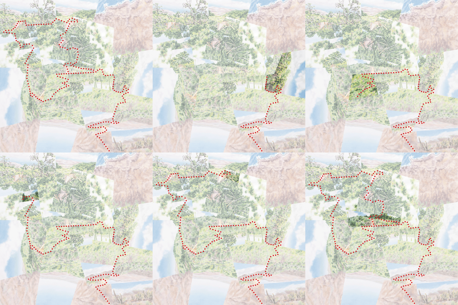
In these pencil sketches/overlays, I worked on shaping the fragments to capture the motion of stepping upward into the hills (from the lower right corner) and then spiraling inward into the forest (top-center).
Capturing and heightening this experience on paper involved a few unique challenges. In terms of composition, it took a fair amount of tinkering to find the right balance of semi-desert, shrubby transition zone, and forest to depict a smooth brown-to-green gradient but also enough of the two extremes to sufficiently emphasize 1) the overall contrast and 2) the centrality of the forest islands (despite their relatively tiny areas) to the experience of the place. Conveying that centrality meant zooming and zeroing in more and more closely (i.e. increasing scale) as the journey progressed, plus shaping and arranging the fragments to create a sense of spiraling inward toward the forest and then coming to rest. So “centrality” incorporates aspects of arrival and stasis as well as (compared to the expansiveness of the landscapes beyond) enclosure and containment.
My abstracted path of travel from dry lowlands to wet highlands, along road and boardwalk.
Detail, semi-desert zone.
Detail, transitional zone.
Detail, forest zone.
Another challenge came during the painting stage (which is never the most interesting part for me, but I can’t pretend it doesn’t take a great deal of thought), when I wanted to chromatically intensify the dry-wet contrast. As you can tell I depict the oasis overall as much more luxuriant than in my photographs (again, taken during the “dry” season) and in the satellite imagery. That might sound like just a matter of adding more green paint, but there are many possible greens, and choosing/combining them is a bigger challenge when I’m trying to create some imagined condition that also unifies the aerial and ground-level views.
As you’ve heard me say before with other fog-scapes, I’d really like to re-visit this one during the “right” time of year. I’m not sure it would necessarily result in a better worldview—the artificial greening might turn out to be more evocative than a representation of the real thing—but it would make for an even more surreal real-world experience.
Darren


