


My newest watercolor map continues a series inspired by islands of native ecology within cities. But as you can guess from the title Oasis II, at the same time it relates back to an earlier work on a different theme, and to another type of ecological island.
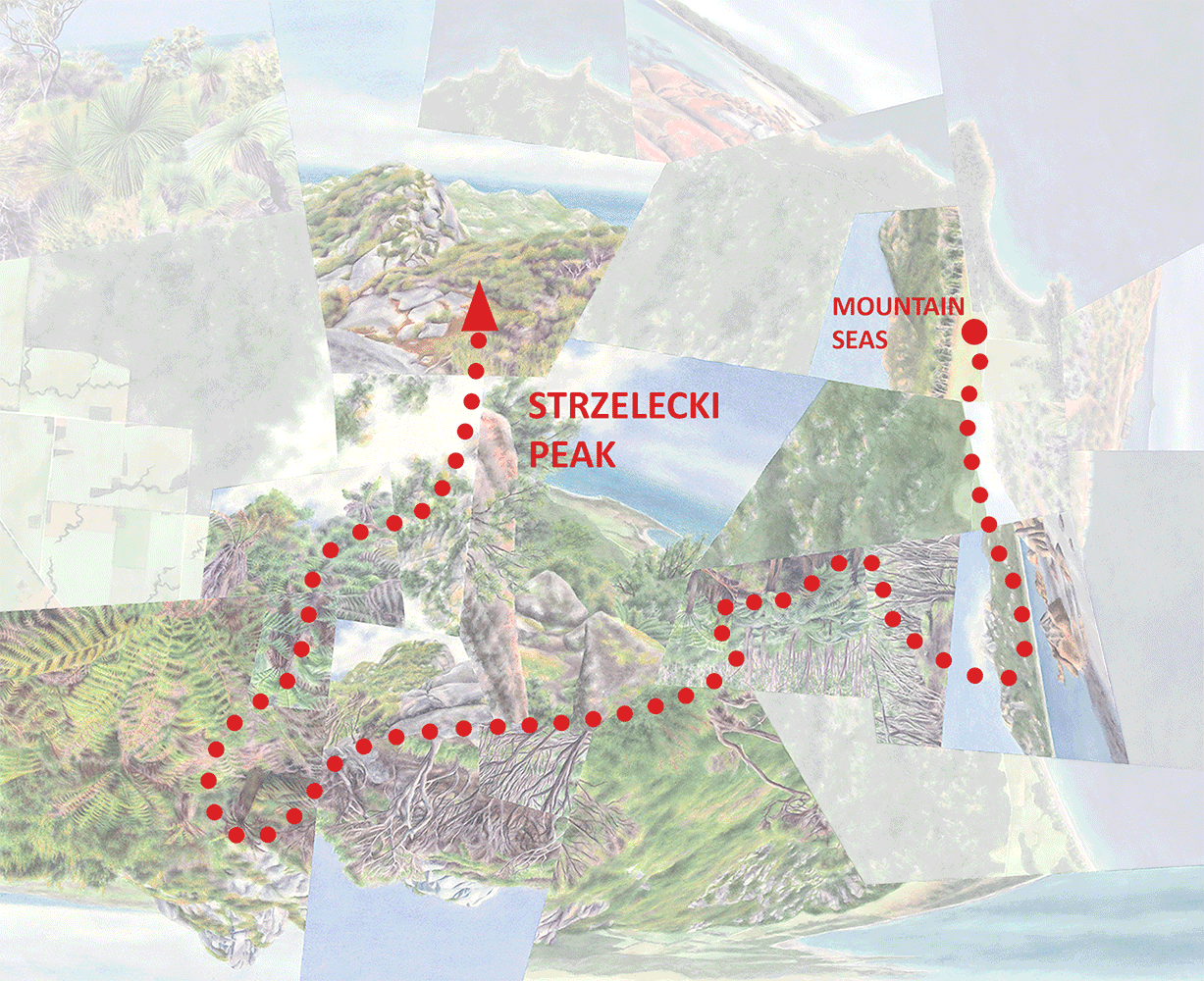
This new map represents the Lomas de Lúcumo, an urban park and nature reserve in Lima, Peru that contains one of many seasonal “fog oases” scattered throughout this desert region—places where mountains intercept the coastal fog layer to create unexpected islands of brilliant green. (Unlike the kind of oasis that most of us are familiar with, then, the water comes from above rather than below.) Oasis (I), completed a few years ago, deals with the same phenomenon, but an example much farther south in north-central Chile where the desert is comparatively lush—dense with giant cacti—and the oasis is an actual forest. In most of coastal Peru though the desert is essentially barren and the lomas (literally “hills”) are a mix of shrubland and grassland or occasionally savanna. Actually an even earlier map, Fog Meadows, depicts another one of these oases a few hours north of Lima that’s ecologically much more similar to Lúcumo than the one I capture in Oasis.

View back toward the city (and the desert, interrupted by some irrigation) from the center of the oasis.
I visited Lúcumo in October 2019 at the tail end of the foggy season; the heart of the oasis was still an almost neon green, but the outer parts were turning a mix of brown and red-orange. So the beige-to-green transition was less abrupt and exhilarating than it probably had been a month or so earlier, but in the watercolor it did make for a more interesting range of views and variety of colors.

Oasis II, watercolor on paper, 30”x40”.
The city-nature juxtaposition that ties this map in with the most recent few is a second type of environmental contrast overlaid on the first, dry-wet one. Or, more precisely, when I was there it seemed to coincide with the outer edge of the dry-wet transition zone that I just mentioned above. In general the urban fabric spreads across the plains surrounding the park and adjacent hills, and at least the sections that I passed through or could see from above (which looked like informal settlements) don’t do much to obscure the desert they were built on—there isn’t much other than sand and gravel in-between structures. The vegetation begins, as dry grass dotted with cacti and bromeliads, where the development stops and the land begins to rise. Toward the center of the reserve—not necessarily the highest parts, but where the shape of the topography tends to concentrate the fog—shrubs and tangled groundcovers replace the grasses and it all becomes greener and greener. I don’t remember seeing any actual trees, but the shrubs approach that size in the wettest zones.

The reserve is accessed by a loop trail, highly distorted when it’s overlaid here on the map. The more transparent segments represent sections of the trail that pass behind topography in the foreground.

Looking into the oasis from the dry lowlands just beyond the edge of the city, at the start of the loop trail. The foreground elevation is high enough (compared to just a few meters back) to support minimal vegetation, which I assume was greener a few weeks or months earlier.

Outcrop in the heart of the oasis.

Walking along the reserve’s main ridgeline.
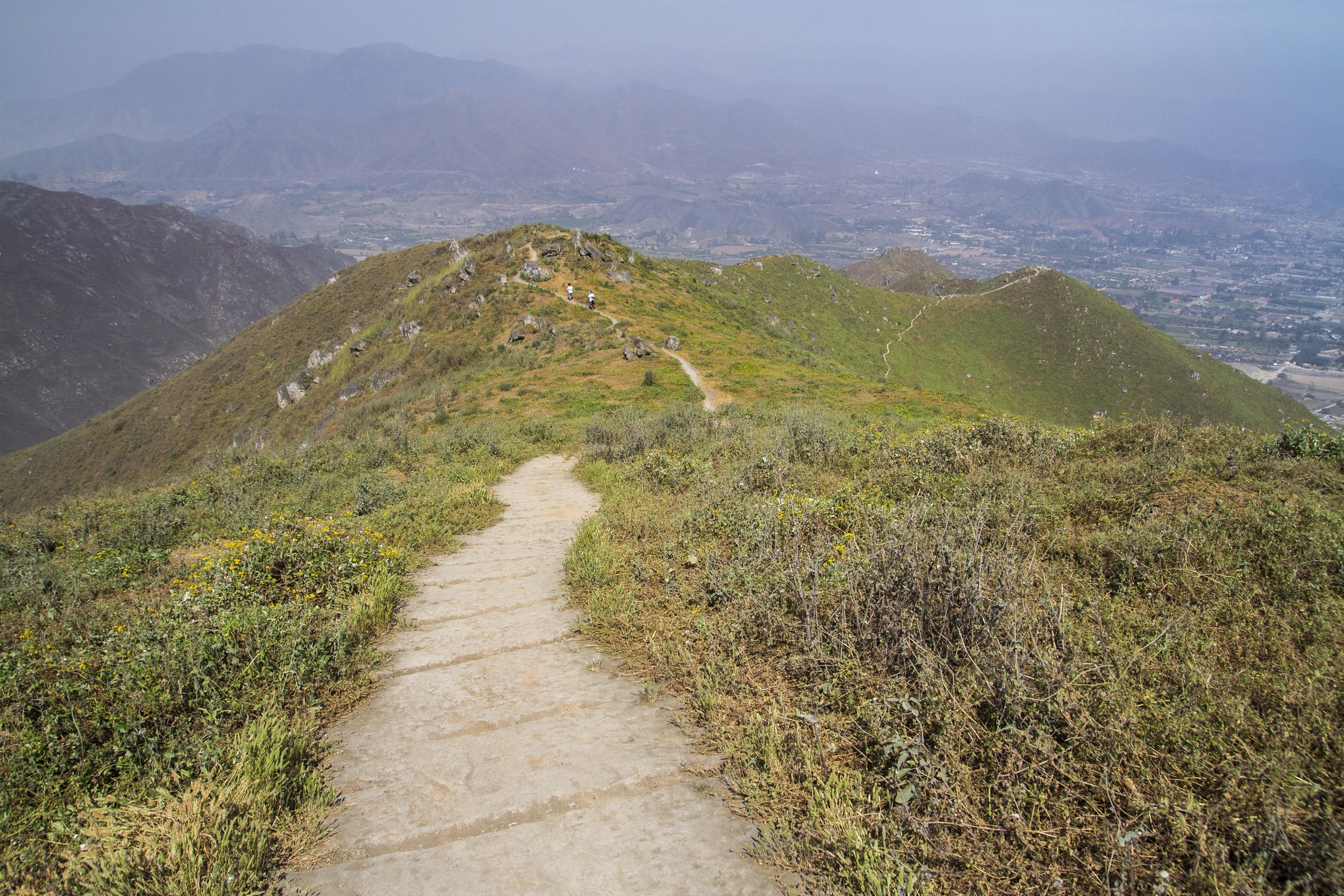
Further along the ridgeline, as the landscape begins to dry out.

Looking down toward the city and desert, with dry transitional vegetation on the intervening hill.

On the descent, looking back up toward the greener ridgeline.

Cacti near the end of the trail…

…and terrestrial bromeliads.

The edge of the reserve.
In my last few posts I’ve written about how the faceted structure of these maps, meant to sharpen and solidify ecological edges, at the same time unintentionally creates a sense of movement and impermanence that I see as representing essentially the opposite—ecological change and interconnectivity. These competing “forces” exist in all the maps to varying degrees, interplaying with each other.
In Oasis II I feel like it’s the sense of movement that predominates, and it has a positive, energetic quality rather than a destructive or unsettling one. (Though I’m sure this impression varies viewer to viewer.) These fog oases do face a number of threats—climate change and invasive species, plus unregulated land use especially in urban contexts like this one. But I think that instability comes across here as just a continuation of ecological change that always been happening, “natural” whether it’s human-caused or not. I generally don’t believe in this interpretation of today’s environmental degradation (hence calling it degradation in the first place), and of course it’s not what I set out to communicate in the maps. But needless to say it’s a fact that nothing is permanent, and it’s fair to claim that the accelerated ecological change that we’re causing today isn’t totally disconnected from that reality, let alone avoidable or reversible.
Darren

Enlargement, “dry” half.

Enlargement, “wet” half.