


My latest (and to date, largest) worldview is inspired by one of the most surreal places I’ve been—Isla Incahuasi in the Salar de Uyuni, the world’s largest salt pan at 3,656m (11,995’) elevation in the Bolivian altiplano. (It’s a rocky outcrop, the top of an ancient “submerged” volcano, that becomes an island in the strict sense after infrequent rain turns the Salar into the world’s largest mirror.) The place is otherworldly in multiple ways: the giant cacti, looking simultaneously menacing and cuddly, studding the island; the blank, perfectly flat expanse of salt beyond; and most strikingly the sharp contrast between the two in terms of color, texture, and terrain.

Location of the Salar de Uyuni (Google Maps image).
The Salar is roughly 110km by 80km (70mi by 50mi), clearly visible on an aerial photo of the entire continent; Isla Incahuasi is a tiny speck close to the center, only about half a kilometer across. Walking the island’s one loop trail to the 150m summit, along with the entire perimeter, can be done in about an hour.

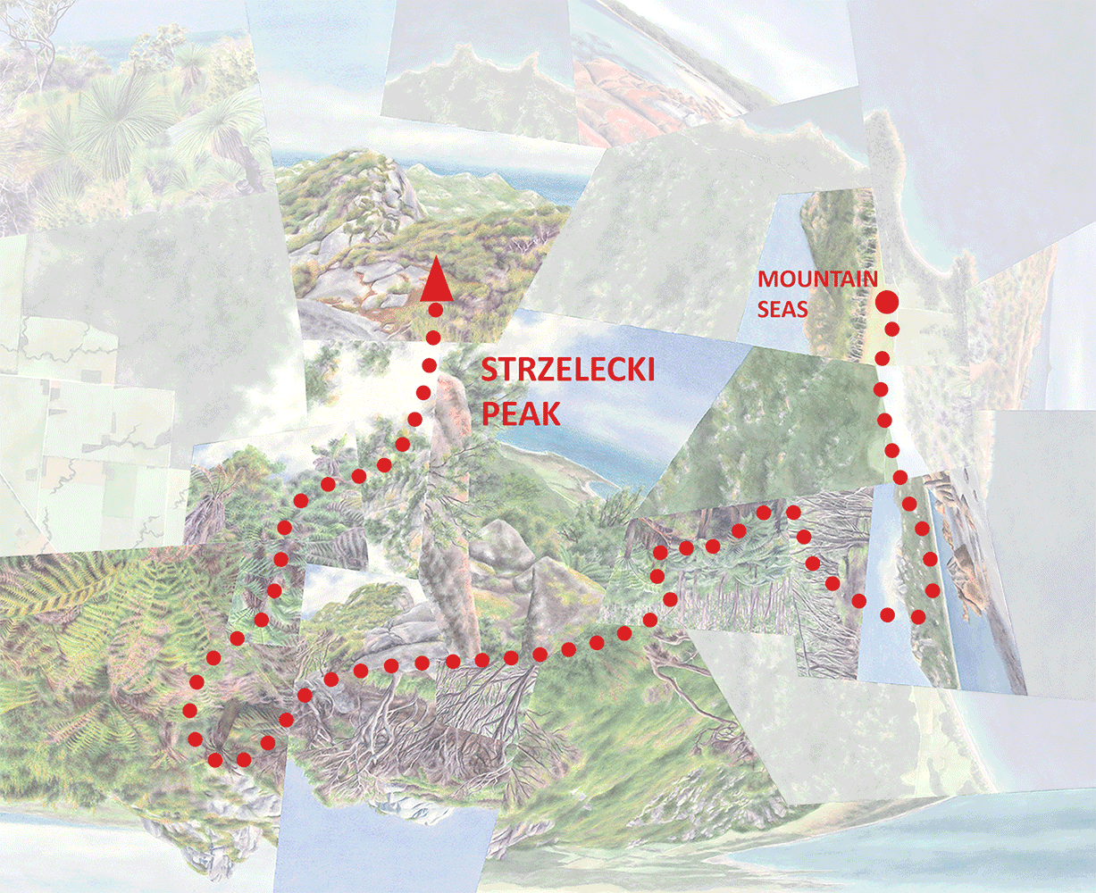
Location of Isla Incahuasi in the Salar, with the rough arrival and departure routes by car on my organized tour—of course no actual roads are necessary!

Loop trail and perimeter walk on/around the island (dashed), and vehicular arrival and departure routes (solid).
The island’s small scale and steep topography guarantee that from any vantage point looking outward, the featureless white forms a prominent backdrop; the salt pan’s dramatic juxtaposition with the rugged cactus-y foreground is ever-present.

Typical view from mid-elevation on the loop trail.

Looking along the northeast peninsula from just below the summit.

View inland toward the central ridgeline.
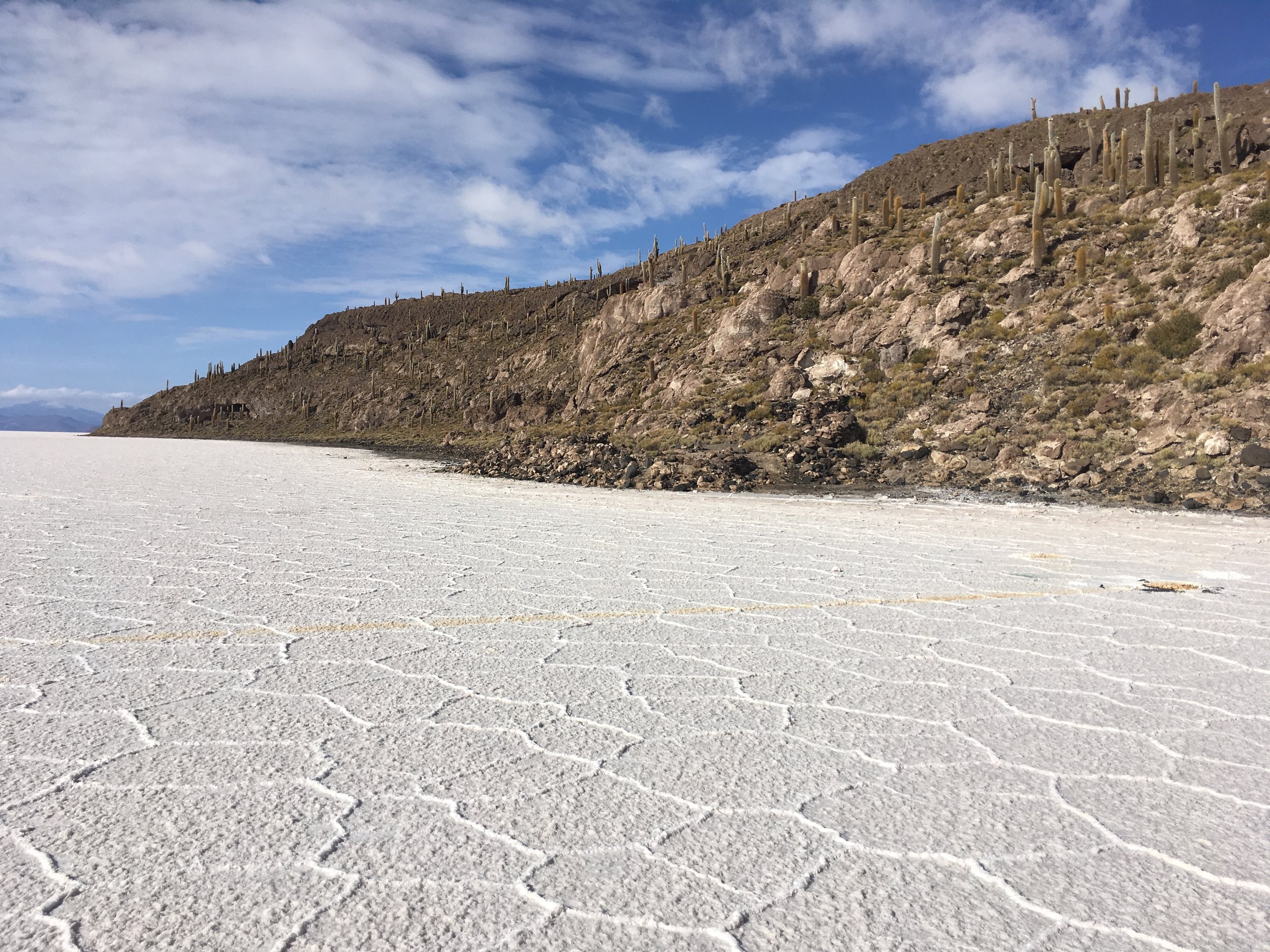
Salt meets stone, with the Salar’s polygonal patterning that inspired the layout of the worldview.
From the island in most directions there are glimpses of the mountainous landscape beyond the Salar, but from certain spots along the drive the plain appears endless.

It’s this sense of contrast and isolation, of a tiny dot floating in a vast sea of white, that I immediately knew I wanted to capture and heighten on paper, with the idea that I’d make the work as big as possible (the full size of my stretching board) and use blank paper to suggest the salt from overhead. I also figured I’d extend the salt pan all the way to the horizon in all the views, leaving out the distant mountains.
I had in mind something even more abstract and minimal than most of my previous works, accentuating the place’s otherworldly, mirage-like feel by depicting space less literally that I usually do…even though that feel depends on spatial relationships (between island and salt pan) in the first place. I pictured striking that balance by using the fewest number of fragments that would still clearly indicate the presence of a physical island.

In my initial sketches though, the composition was too complex. As usually happens I had too many views I wanted to incorporate; plus, I got a bit carried away with my idea to use a compositional structure of many-sided polygons to recall the distinctive pattern of mini-ridges on the salt pan.
I decided to eliminate all the aerial views (other than a minimum number of blank “salt” fragments)—the volcano beyond the edge of the Salar (at the top of the composition) obviously worked against the isolation theme, plus removing them would have the added benefit of heightening the dreamlike atmosphere by making the cartographic aspect more purely conceptual. (In fact the final version points back toward the style of my oil paintings, which generally didn’t include aerial perspectives. As I’ve written I consider those to be maps too, but they tend to have a more ethereal quality than the watercolors.) But the design was still too busy, and I also wasn’t happy with the relative areas of the two main elements (island and salt). I needed to maintain the island’s sense of smallness and isolation, but it kept getting bigger as I wanted at the same time to immerse the viewer in the feeling of standing on it.

Many more iterations later I had something that resolved these issues, with a more linear, “strung out” configuration for the island that I think further plays up the abstraction. (It’s also, appropriately, a bit suggestive of a brine shrimp.)

Crystallize, watercolor on paper, 52”x40.”

Crystallize overlaid with the routes of travel (the transparent segments run behind the landforms).
The title Crystallize references not just salt crystals but also the island’s mirage-like quality, seeming to materialize out of nothing and float in mid-air.
You can see that the route overlay doesn’t work out very well with the summit trail, since the reduced number of images means that a large segment isn’t covered (actually it’s “hidden” behind the view of the island’s central ridgeline). But it highlights the difference in approach between this map and my other, more straightforwardly map-like works.
Darren

Detail, top half of the island.

Detail, bottom half of the island.